

Why Don't They Call Them “Northeastern Hurricanes”?
Sandbar Sofa Surfers Science Academy
Oceanography • Meteorology • Tropical Cyclone Science • Northeast Florida
Here's a fascinating question for the Science Academy: If hurricanes can develop in the Atlantic Ocean and move toward the northeastern United States, why don't meteorologists call them “Northeastern Hurricanes” during hurricane season?
And for those of us watching the waves in Jacksonville, Mayport, and Atlantic Beach, there's an even more interesting question hiding underneath: Does a hurricane have to hit Florida to change our surf?

The short answer is that hurricanes are named and classified by their storm characteristics, not by the region they are heading toward. But geography, atmospheric circulation, and ocean temperatures determine where they form, which direction they travel, and what kind of waves they send toward our coastline.
Let's investigate.
1. The mystery: geography doesn't determine the name
The National Oceanic and Atmospheric Administration (NOAA) explains that hurricanes are tropical cyclones that form over warm tropical or subtropical waters. The Atlantic basin uses an internationally coordinated list of names rather than naming storms after the coastline they approach.
National Oceanic and Atmospheric Administration
Consider these examples:
Hurricane

A warm-core tropical cyclone with sustained winds of at least 74 mph. It can travel north and affect the Carolinas, the Mid-Atlantic, or New England without receiving a new regional name.
Nor'easter

A different type of coastal storm, often fueled by contrasts between cold air and warmer ocean water. Its name describes the characteristic northeast winds affecting the region, not a hurricane category.
NESDIS
Here's the important distinction: a hurricane moving toward the Northeast is still called a hurricane. A storm developing near the Northeast coast is not automatically a hurricane.
2. What makes this important to Jacksonville surfers?
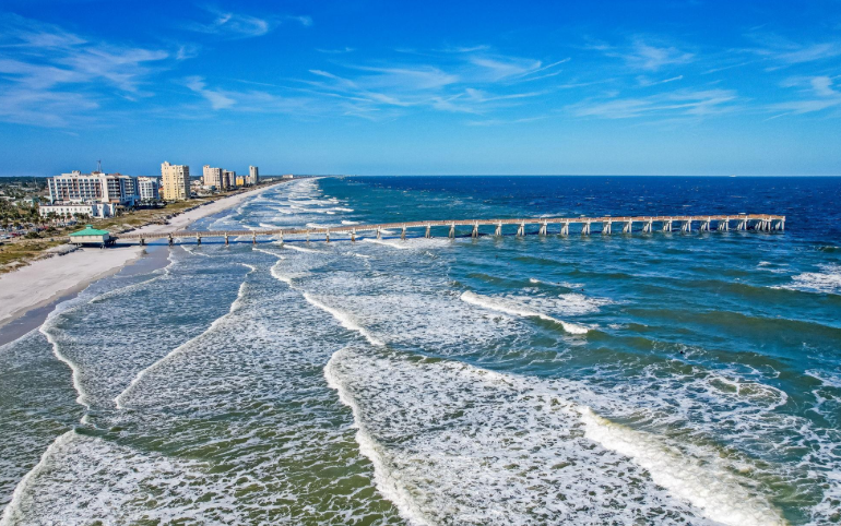
Our Northeast Florida coastline occupies an interesting position. A hurricane doesn't have to make landfall in Jacksonville to affect our waves.
The storm's position, movement, wind field, and interaction with the surrounding atmosphere all influence what reaches our beaches.
Storm offshore to the northeast: Depending on its track and wind field, it may generate useful swell traveling toward Northeast Florida.
Storm in the Gulf of Mexico: It can sometimes generate waves that reach Florida's Atlantic coast, but the outcome depends on storm location, wind direction, fetch, and swell propagation.
Storm moving away from Florida: Long-period swell can arrive after the storm has moved farther away.
Storm passing too close: Strong onshore winds, dangerous currents, storm surge, and disorganized surf may outweigh any improvement in wave size.
These are possible scenarios, not a forecast for any particular storm. The actual wave response requires current storm-track information and ocean observations.
3. The Science Academy experiment: name the storm or name its effects?
Let's separate two things meteorologists measure:
Atmospheric identity
Is the system a tropical cyclone, hurricane, or extratropical cyclone? Its structure and energy source help determine its classification.
Ocean response
What swell direction, wave period, wave height, and local wind conditions will Jacksonville experience? Those measurements determine the surf implications.
A hurricane's name is useful for communication and public safety. But for surfers, the storm's name alone tells us very little about whether the waves will be rideable.
National Ocean Service
4. A field investigation for Sandbar Sofa Surfers
Try this observation exercise the next time an Atlantic storm moves northward.
Storm-to-Surf Observation Log
Check each item as you investigate a storm using NOAA forecasts and local buoy or surf observations.
Record the storm's location and direction of travel.
Identify the forecast wind field and strongest winds.
Record the swell direction and dominant wave period at an offshore buoy.
Compare offshore wave conditions with Jacksonville Beach or Mayport observations.
Note whether local winds improve or deteriorate the surf conditions.
0 of 5 observations completed
Reset log
5. The bigger question: should we have a regional hurricane classification?
Your question raises an interesting possibility. Imagine a public-facing system that identifies not just the storm, but also its regional impacts:
Atlantic tropical cyclone
Northeast U.S. coastal impact
Northeast Florida swell-producing system
Gulf-origin system affecting the Atlantic coast
These would be impact descriptions, not official hurricane classifications. They could help coastal communities and surfers understand why a storm matters to their region.
The National Hurricane Center already tracks storms across the Atlantic basin and communicates their hazards. A regional impact label could complement that information, provided it doesn't confuse people about the official storm classification.
National Oceanic and Atmospheric Administration
Science Academy conclusion
The reason we don't call them “Northeastern hurricanes” is that hurricane terminology describes a storm's meteorological identity and ocean basin, not simply the direction it travels or the area it affects.
But from a Northeast Florida surfing perspective, your question points to something valuable: we need to understand storms regionally, because a storm's identity and a coastline's response are two different scientific questions.
For Sandbar Sofa Surfers, that's a lesson worth teaching: don't just follow the hurricane. Follow the physics connecting the atmosphere to the ocean.
NOAA research references
National Oceanic and Atmospheric Administration — Hurricanes: NOAA Education
NOAA National Environmental Satellite, Data, and Information Service — What Is a Nor'easter?
NOAA National Ocean Service — Why Do We Name Tropical Storms and Hurricanes?
NOAA National Weather Service — Tropical Definitions


Comments